Log in
All resources
Create a design
48 Free Artworks of 1835 Maps
maastricht in the 1820s
maastricht in the 1830s
marcellin jobard
cary's new itinerary (1815)
maps in hcl (maastricht)
19th-century maps of maastricht
oil on canvas
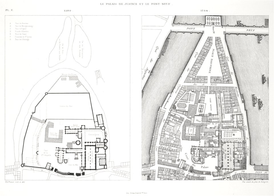
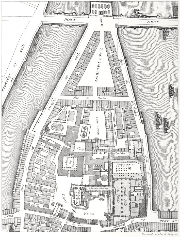
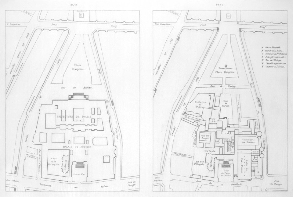
lithographs of paris
paris à travers les âges
historical images of palais de justice de paris
portrait paintings of ferdinand ii of the two sicilies
giuseppe bonolis
portraits of marshals of france (series commissioned by louis philippe i - versailles)
henri-frédéric schopin
paris à travers les âges
lithographs of paris
maps indicating exploration
royal geographical society
maps in the library of congress
romanticism
victory expedition
northwest passage
victory expedition
northwest passage
19th-century portrait paintings in the musée national du château de versailles
jean-baptiste mauzaisse
eran laor cartographic collection
romanticism
maps by juan lopez
1835 maps of spain
eran laor cartographic collection
romanticism
paris à travers les âges
lithographs of paris
paris à travers les âges
lithographs of paris
hollandsche ijzeren spoorweg-maatschappij
willem christiaan brade
19th-century maps of maastricht
maps in hcl (maastricht)
portrait of george washington by giuseppe perovani
1790s maps of washington, d.c.
drawings in hcl (maastricht)
maastricht in the 1820s
eran laor cartographic collection
romanticism
prints, drawings and watercolours of the royal museums greenwich
1835 maps
drawings in hcl (maastricht)
maastricht in the 1820s
19th-century maps of maastricht
maps in hcl (maastricht)
19th-century maps of maastricht
maps in hcl (maastricht)
narrative of the arctic land expedition to the mouth of the great fish river - and along the shores of the arctic ocean, in the years, 1833, 1834, and 1835 (1836)
maps in hcl (maastricht)
marcellin jobard
admiralty charts region b: england wales ireland english channel southern north sea
admiralty charts 1401-1600
maps in the rijksmuseum amsterdam
old maps of suriname
19th-century maps of maastricht
maps in hcl (maastricht)
chambre des députés (july monarchy)
maps from gallica
maps in the rijksmuseum amsterdam
old maps of suriname
cary's new itinerary (1815)
1810s maps of england
19th-century maps of europe
maps by john cary
19th-century maps of europe
maps by john cary
19th-century portrait paintings in the musée national du château de versailles
jean alaux
jean-baptiste mallet
medici venus in art
paris à travers les âges
lithographs of paris
maps, prints and photographs in royal danish library
photographs by peter most
portrait of george washington by giuseppe perovani
giuseppe perovani
maps in the rijksmuseum amsterdam
leidens ontzet
admiralty charts region u: north america east coast
admiralty charts 201-400
19th-century maps of gloucestershire
old maps of cheltenham
19th-century maps of the isle of wight
cary's new itinerary (1815)
19th-century maps of middlesex
cary's new itinerary (1815)
19th-century maps of hampshire
cary's new itinerary (1815)
19th-century maps of somerset
cary's new itinerary (1815)
cary's new itinerary (1815)
19th-century maps of kent
china under the empress dowager
historical maps of beijing
collections of maison de balzac
men in bed in art
drawings in musée carnavalet
série 01. paris. rive droite
1 - 48 of 48
/ 1